
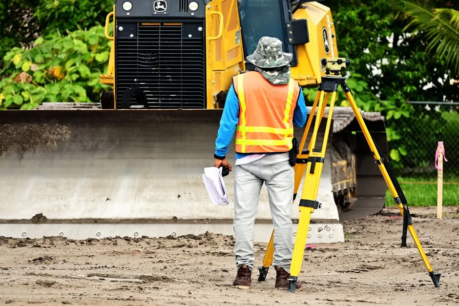
A surveyor is often the first technical professional to translate a piece of land into measurable, usable information. Before a foundation is poured, a road is widened, or a property line is defended in court, the surveyor’s measurements and documentation establish what is real, what is legal, and what is feasible. This work is not limited to placing stakes in the ground; it blends geometry, mapping, field observation, and careful reporting into records that engineers, architects, planners, and owners can rely on. When budgets are tight and timelines are aggressive, accurate surveying can prevent expensive rework, boundary disputes, and construction delays. The surveyor’s output—plans, plats, control points, coordinates, and reports—becomes a shared reference that aligns multiple teams and keeps decisions grounded in verified data.
Table of Contents
- My Personal Experience
- Understanding the Surveyor’s Role in Modern Projects
- Core Responsibilities: Boundaries, Topography, and Control
- Tools and Technology Used by a Surveyor
- Education, Licensing, and Professional Standards
- Boundary Surveys and Property Rights: Why Precision Matters
- Construction Surveying: From Layout to As-Builts
- Land Development and Planning Support
- Expert Insight
- Specializations: Hydrographic, Geodetic, and Forensic Surveying
- How to Hire the Right Surveyor for Your Needs
- Common Challenges a Surveyor Must Manage
- Deliverables and Documentation: What You Should Expect
- The Future of the Surveyor Profession
- Watch the demonstration video
- Frequently Asked Questions
- Trusted External Sources
My Personal Experience
Last summer I shadowed a surveyor for a week on a small road-widening project outside town, and I was surprised by how much patience the job takes. We’d start early to beat the heat, hauling the tripod and GPS rover to the edge of the right-of-way while traffic rushed past a few feet away. Most of the day was careful, repetitive work—setting control points, checking benchmarks, and re-shooting anything that didn’t line up—because one bad measurement can ripple through an entire design. The surveyor kept a worn field book in his vest and still double-checked the digital points by hand, especially near old property pins that were half-buried in weeds. By the end of the week I understood why he said the hardest part isn’t the math, it’s staying consistent when the ground is uneven, the weather shifts, and everyone wants the answers yesterday.
Understanding the Surveyor’s Role in Modern Projects
A surveyor is often the first technical professional to translate a piece of land into measurable, usable information. Before a foundation is poured, a road is widened, or a property line is defended in court, the surveyor’s measurements and documentation establish what is real, what is legal, and what is feasible. This work is not limited to placing stakes in the ground; it blends geometry, mapping, field observation, and careful reporting into records that engineers, architects, planners, and owners can rely on. When budgets are tight and timelines are aggressive, accurate surveying can prevent expensive rework, boundary disputes, and construction delays. The surveyor’s output—plans, plats, control points, coordinates, and reports—becomes a shared reference that aligns multiple teams and keeps decisions grounded in verified data.

Because land is both a physical asset and a legal concept, a surveyor operates at the intersection of measurement and rights. Physical features can shift over time, monuments can be disturbed, and historical descriptions can be vague or inconsistent, yet ownership and responsibilities still need to be defined. A competent surveyor interprets deeds, easements, recorded plats, and historical evidence, then reconciles that documentation with what is found on site. The result is not merely a map; it is a defensible professional opinion supported by standards, methodology, and traceable evidence. Whether supporting a residential fence placement or a multi-phase infrastructure project, the surveyor’s role remains foundational: establish reliable control, document existing conditions, and provide authoritative boundary and topographic information that others can build upon.
Core Responsibilities: Boundaries, Topography, and Control
One of the most recognized tasks of a surveyor is boundary surveying, where the goal is to locate and mark property lines based on legal descriptions and evidence on the ground. That process involves research—reviewing deeds, title documents, subdivision plats, and recorded easements—followed by fieldwork to locate monuments, measure distances, and assess occupation lines such as fences or walls. The surveyor must weigh conflicting evidence, identify gaps or overlaps, and apply professional judgment consistent with local statutes and established surveying principles. A boundary survey often culminates in a plat or plan showing bearings, distances, monuments found or set, adjacent owners, and relevant encumbrances. For property owners, that deliverable can influence purchases, sales, financing, and development decisions, because it clarifies what is owned and what is restricted.
Topographic surveying is another essential responsibility, especially for design and construction. Here, the surveyor captures the shape and features of the land: elevations, slopes, drainage paths, buildings, utilities, trees, pavements, and other improvements. Engineers use that information to model grading, stormwater management, roadway alignments, and building placement. The surveyor typically establishes horizontal and vertical control—reference points with known coordinates and elevations—so that all measurements are tied to a consistent framework. Control surveying may involve connecting to national or regional coordinate systems, running levels to establish benchmarks, and setting durable points that construction teams can reference throughout the project. In practice, the surveyor’s attention to control is what allows different trades and phases to fit together accurately, reducing cumulative errors that can otherwise compound across months of work.
Tools and Technology Used by a Surveyor
A modern surveyor relies on a toolkit that blends traditional instruments with advanced positioning technology. Total stations remain a mainstay, combining electronic distance measurement and angular measurement to compute precise coordinates. A surveyor sets up the instrument over a known point, sights to a prism or reflective target, and records measurements that can be processed into linework and surfaces. Digital levels improve efficiency and accuracy for elevation work, especially when establishing benchmarks or verifying construction grades. Field controllers and data collectors store observations, apply coding for features, and help ensure consistent data capture. Even with automation, the surveyor’s skill matters: instrument setup, calibration checks, sighting discipline, and a clear plan for redundancy and validation are what make results dependable.
GNSS (Global Navigation Satellite System) has expanded what a surveyor can accomplish, particularly across large sites or in areas where line-of-sight is difficult. Using RTK (Real-Time Kinematic) or network corrections, a surveyor can obtain centimeter-level positioning in real time, often faster than conventional traversing. However, GNSS is not a universal solution; tree canopy, multipath reflections near buildings, and limited sky view can degrade performance. Many projects use a hybrid approach, where a surveyor establishes primary control with GNSS and densifies control with total station observations for critical areas. Laser scanning and mobile mapping have also become common, generating dense point clouds that capture existing conditions in extraordinary detail. Yet, even with scanning, a surveyor must plan targets, manage registration, validate accuracy, and interpret the data so it serves design intent rather than becoming an overwhelming mass of points with unclear reliability.
Education, Licensing, and Professional Standards
Becoming a surveyor typically involves a combination of formal education, supervised experience, and licensing examinations. Requirements vary by jurisdiction, but many regions expect a degree or substantial coursework in surveying, geomatics, civil engineering technology, or a related field. Field experience under a licensed professional is a major component, because surveying is as much applied judgment as it is mathematics. A surveyor learns how to interpret boundary evidence, handle conflicting records, plan efficient field procedures, and document decisions in a way that can stand up to scrutiny. Licensing exams often cover topics such as boundary law principles, measurement science, geodesy, mapping, and professional ethics. The licensed surveyor is accountable to a regulatory board and must adhere to standards of practice that protect the public and preserve trust in land records.

Professional standards affect how a surveyor performs and reports work. Accuracy classifications, monumentation rules, record research expectations, and minimum deliverable content can be spelled out by statutes, board rules, or professional organizations. For example, some areas require specific types of corner markers, detailed plat notes, and explicit statements about the basis of bearings and coordinate systems used. A surveyor may also need to meet client-driven specifications, such as engineering tolerances for construction staking or vertical accuracy for drainage design. Continuing education is common, reflecting the pace of technology and the evolving nature of land development and infrastructure. Ultimately, licensing is not a formality; it signals that a surveyor has met competency thresholds and accepts responsibility for the integrity of measurements and the consequences of decisions tied to property rights and public safety.
Boundary Surveys and Property Rights: Why Precision Matters
Boundary issues can be emotionally charged and financially significant, which is why the surveyor’s approach must be methodical and defensible. A boundary survey is not just about measuring what is visible; it is about locating the legally intended lines based on the best available evidence. That evidence may include original subdivision monuments, deed calls, occupation lines, historical surveys, and even testimony or long-standing acceptance of a boundary in certain contexts. A surveyor evaluates the hierarchy of evidence recognized in the jurisdiction, then reconciles measurements with record information. When discrepancies appear—such as gaps, overlaps, or missing monuments—the surveyor documents findings, applies professional judgment, and may set new monuments in accordance with rules. The resulting plan can influence building setbacks, driveway placement, fencing decisions, and future conveyances, making the surveyor’s work a cornerstone of long-term property clarity.
Precision matters because small errors can have large consequences. A few inches may not sound like much until it affects a required setback, encroaches on an easement, or triggers a dispute with a neighbor. A surveyor also considers practical realities: fences may be built off-line, old markers may have been moved, and natural features referenced in historic deeds may have shifted. Rather than relying on a single measurement, a careful surveyor designs fieldwork with redundancy—multiple observations, closed traverses, and checks against control—to identify blunders and quantify uncertainty. Clear communication is equally important; plats and reports should explain what was found, what was set, and how conclusions were reached. When handled well, a boundary survey reduces risk for buyers, lenders, and owners, and it provides a credible basis for resolving conflicts without escalating to costly litigation.
Construction Surveying: From Layout to As-Builts
Construction projects depend on a surveyor to translate design drawings into real-world positions and elevations. Construction staking, also called layout, involves marking where foundations, footings, columns, utilities, curbs, and other elements should be built. The surveyor establishes project control, verifies the coordinate basis, and sets stakes or marks that guide contractors. This work requires precision and clarity: stakes must be labeled correctly, offsets must be logical and safe from disturbance, and elevation references must be unambiguous. A surveyor also collaborates with project managers and superintendents to sequence work, respond to field changes, and address conflicts between plans and site conditions. When done correctly, layout reduces rework and helps maintain alignment between disciplines—structural, civil, and mechanical—so that components fit as intended.
Beyond layout, a surveyor often performs verification and as-built surveying. Verification checks confirm that installed work meets design tolerances, such as pipe slopes, anchor bolt locations, or pavement elevations. As-built surveys document what was actually constructed, which is essential for record drawings, future maintenance, and regulatory approvals. On complex sites, a surveyor may monitor settlement or movement, measuring points over time to detect deformation in retaining walls, adjacent buildings, or excavation support systems. Construction surveying is time-sensitive, and errors can be expensive, so a professional surveyor implements quality control: instrument checks, independent calculations, and clear recordkeeping. The value is not only in accurate points, but in reliable coordination—ensuring that everyone on site is building the same project, anchored to the same control, and working from measurements that can be trusted.
Land Development and Planning Support
Land development brings together zoning, engineering, environmental constraints, and market needs, and a surveyor provides the spatial foundation for balancing those forces. Early in a project, a surveyor may produce an existing conditions plan that captures boundaries, topography, drainage patterns, utilities, and structures. This information supports feasibility decisions: where buildings can sit, how roads can connect, what grading might cost, and whether stormwater can be managed without excessive retaining walls or off-site impacts. A surveyor’s data also helps identify constraints such as floodplains, wetlands buffers, or access easements. By tying features to reliable coordinates and elevations, the surveyor enables designers to test alternatives confidently, rather than guessing at slopes or relying on outdated mapping.
| Type of surveyor | Main focus | Typical deliverables | When you’d hire one |
|---|---|---|---|
| Land (Boundary) Surveyor | Property lines, easements, encroachments, legal descriptions | Boundary survey/plat, stakes/markers, legal description updates | Buying/selling property, fence/building placement, boundary disputes |
| Construction (Engineering) Surveyor | Setting out and verifying positions/elevations for construction | Site layout/staking, as-built survey, grade checks | New builds, roads/utilities, ensuring work matches plans and tolerances |
| Quantity Surveyor | Cost planning and contract administration for projects | Cost estimates, bills of quantities, tender analysis, valuations | Budgeting and managing construction costs from design through completion |

Expert Insight
Before hiring a surveyor, confirm their license, insurance, and experience with your specific project type (boundary, topographic, construction staking). Ask for a sample deliverable and a clear scope that lists what will be marked on-site, what will be shown on the plan, and how disputes or encroachments will be reported.
To keep costs and delays down, gather and share existing documents upfront—deeds, prior surveys, plats, and any easements—and ensure the site is accessible (unlocked gates, cleared brush around corners, visible monuments if known). Walk the property with the surveyor to point out fences, stakes, and known issues so the fieldwork targets the right areas the first time.
As development advances, a surveyor often supports subdivision design and permitting. This can include preparing preliminary plats, final subdivision plats, and records of survey that meet local requirements for monumentation and document formatting. The surveyor may coordinate with engineers to ensure lot lines align with grading, drainage easements, and utility corridors. When agencies require specific mapping standards, the surveyor ensures deliverables match those standards, reducing review cycles and delays. During construction, the surveyor’s control and staking help translate approved plans into built reality, and after completion, the surveyor’s as-built documentation can support acceptance by municipalities or utility providers. In this way, the surveyor functions as a continuity professional across the project lifecycle, keeping land records, design intent, and construction outcomes aligned.
Specializations: Hydrographic, Geodetic, and Forensic Surveying
Many surveyor careers branch into specialized areas that require additional methods and domain knowledge. Hydrographic surveying focuses on measuring underwater features for navigation, dredging, shoreline stabilization, pipeline routes, and environmental studies. A hydrographic surveyor may use sonar systems, tidal corrections, and vessel positioning to map bathymetry and underwater obstacles. Data processing can be complex, involving sound velocity profiles, sensor calibration, and careful integration of depth measurements with horizontal positioning. The work often supports engineering decisions that are sensitive to small changes in depth, such as determining dredge quantities or verifying safe clearances for marine traffic.
Geodetic surveying addresses measurements across larger areas where Earth’s curvature and coordinate reference systems matter. A geodetic surveyor may establish high-accuracy control networks, connect projects to national datums, and manage transformations between coordinate systems. This is crucial for infrastructure that spans long distances, such as highways, rail corridors, and pipelines, where small angular differences can accumulate. Forensic surveying, another specialization, supports investigations and legal cases by reconstructing events or analyzing boundary and mapping evidence. A forensic surveyor might document accident scenes, measure skid marks and sight lines, or evaluate whether construction encroached beyond permitted limits. In each specialization, the surveyor’s credibility depends on transparent methodology, traceable measurements, and reporting that anticipates scrutiny from regulators, engineers, attorneys, and courts.
How to Hire the Right Surveyor for Your Needs
Choosing a surveyor starts with matching qualifications to the scope and risk of the work. For a boundary issue, confirm the surveyor is licensed in the project’s jurisdiction and experienced with similar property types—urban lots, rural acreage, waterfront parcels, or complex subdivisions. Ask what records research will be performed and what deliverables you will receive, such as a signed and sealed plat, corner markers set, and a written description of the basis of bearings. If the goal is design support, ask how the surveyor captures topography, what accuracy can be expected, and whether utilities will be located by survey observation, record mapping, or coordination with utility locating services. A reliable surveyor will explain assumptions clearly, because misunderstandings about scope are a common source of dissatisfaction.
Communication and documentation practices are just as important as equipment. Ask how the surveyor handles quality control, how field notes and digital observations are stored, and how changes are managed if site conditions differ from records. For construction staking, ask about control setup, the format of stake reports, and the process for verifying critical elements. Turnaround time matters, but it should be balanced against thoroughness; a surveyor rushing boundary work without adequate research can create long-term problems. Also discuss access needs, such as permission to enter neighboring properties to search for monuments, and clarify who is responsible for coordinating that access. A professional surveyor will provide a proposal that defines scope, schedule, deliverables, and fees in a way that aligns expectations and reduces the chance of surprises.
Common Challenges a Surveyor Must Manage
Field conditions can make surveying far more complex than it appears from a clean set of plans. Vegetation, uneven terrain, traffic, construction activity, and limited line-of-sight can slow progress and introduce risk. A surveyor must also manage safety: working near roadways, excavations, heavy equipment, or water requires planning, personal protective equipment, and sometimes traffic control. Weather can affect both productivity and measurement quality, especially for GNSS work where atmospheric conditions can influence signal performance. A careful surveyor plans for redundancy and checks, ensuring that if one method is compromised—such as GNSS under dense canopy—another method, like total station traversing, can maintain accuracy.
Records and legal descriptions can be equally challenging. Deeds may reference old monuments that no longer exist, bearings may be based on outdated meridians, and subdivisions may have been built in ways that differ from recorded plats. A surveyor often encounters “junior-senior” rights issues, ambiguous calls, or historical surveying practices that do not match modern expectations. Reconciling these problems requires experience, local knowledge, and a disciplined approach to evidence. Technology introduces its own challenges: coordinate transformations, datum shifts, and software settings can create systematic errors if not managed carefully. A professional surveyor mitigates these risks through documented workflows, independent checks, and clear reporting that explains what was done and why the conclusions are reasonable given the available evidence.
Deliverables and Documentation: What You Should Expect
The deliverables from a surveyor depend on the project type, but they generally share a common purpose: provide reliable, interpretable information that others can use. For boundary work, expect a signed and sealed plat or record of survey showing property lines, bearings and distances, monuments found and set, adjoining parcels, and relevant easements or rights-of-way. The surveyor may also provide corner staking in the field so that lines can be identified physically. For topographic work, deliverables may include CAD files, surface models, contour maps, and annotated plans showing spot elevations and feature linework. A surveyor should state the coordinate system and vertical datum used, along with any assumptions or limitations that affect how the data should be applied.

Construction-related deliverables often include stakeout reports, cut/fill sheets, control descriptions, and as-built drawings or point files. A surveyor may provide a control diagram showing point locations, coordinates, and descriptions so that contractors can protect and reuse them. For projects requiring coordination among multiple disciplines, the surveyor may deliver data in specific formats, such as DWG, DXF, LandXML, or GIS shapefiles, and may include metadata that documents accuracy, collection dates, and methods. Good documentation reduces disputes later, because it creates a traceable record of what was measured, when it was measured, and how it ties to project control. When reviewing deliverables, look for clarity and completeness; a surveyor’s work should be understandable to engineers and reviewers without requiring guesswork about the basis of the measurements.
The Future of the Surveyor Profession
The surveyor profession continues to evolve as projects demand faster delivery, richer datasets, and tighter coordination across design and construction. Reality capture, including terrestrial laser scanning, drone photogrammetry, and mobile LiDAR, is changing how existing conditions are documented. These tools can dramatically increase detail, but they also raise expectations for data management, classification, and accuracy reporting. A surveyor who can integrate point clouds with traditional control networks provides a powerful bridge between high-density visualization and legally defensible measurement. At the same time, cloud-based collaboration and digital delivery standards are becoming common, which means a surveyor must think about version control, metadata, and interoperability so that data remains reliable as it moves between software platforms and stakeholders.
Even as technology advances, the need for professional judgment remains central. Boundary determination, evidence evaluation, and the application of standards cannot be automated away, because they depend on context, legal frameworks, and responsibility to the public. As infrastructure and urban development expand, surveyors are also being called upon for monitoring, resilience planning, and asset management, where precise spatial data supports long-term maintenance and risk reduction. The surveyor’s value will increasingly be measured by the ability to deliver accurate results efficiently while documenting methods transparently and ethically. Whether supporting a homeowner, a developer, or a public agency, the surveyor remains essential: translating land and built environments into trustworthy measurements that guide decisions, protect rights, and reduce costly uncertainty.
Watch the demonstration video
In this video, you’ll learn what a surveyor does and why their work matters in construction and land ownership. It explains how surveyors measure and map land, set property boundaries, and use tools like GPS and laser equipment. You’ll also see how their findings help prevent disputes and guide safe, accurate building projects.
Summary
In summary, “surveyor” is a crucial topic that deserves thoughtful consideration. We hope this article has provided you with a comprehensive understanding to help you make better decisions.
Frequently Asked Questions
What does a surveyor do?
A surveyor measures land, property boundaries, and site features to produce maps, plans, and legal descriptions for construction, development, and land transactions.
When do I need a surveyor?
Typical situations where you’ll want a **surveyor** include buying or selling a property, adding an extension or putting up a fence, subdividing land, settling boundary disputes with neighbors, or planning construction projects and utility installations.
What types of surveys are available?
Typical types include boundary surveys, topographic surveys, ALTA/NSPS land title surveys, construction staking, as-built surveys, and subdivision/platting surveys.
How long does a land survey take?
Timelines can vary depending on the property’s size, the terrain, how complex the records are, and the surveyor’s current workload—but for many residential properties, the process typically takes anywhere from a few days to a couple of weeks from booking to receiving the final deliverables.
How much does a survey cost?
Pricing varies based on your location, the size of the lot, site access, how much research is required, the type of survey you need, and the deliverables you want. The best approach is to request a few quotes from a qualified **surveyor** and confirm exactly what’s included—such as boundary markers, a stamped plan, and a written report.
Will a surveyor mark my property corners?
Often yes—surveyors may set or locate corner monuments and flag them, but the exact marking method depends on local standards, site conditions, and the scope of work.
? Looking for more info about surveyor? Follow Our Site for updates and tips!

Trusted External Sources
- Surveyor – El Dorado County
At the Surveyor’s Office, our team manages surveys conducted by licensed professionals and maintains county records. We also provide support to developers and …
- The Surveyor Program – Lunar and Planetary Institute
The Surveyor program consisted of seven unmanned lunar missions that were launched between May 1966 and January 1968.
- Surveying – Wikipedia
A professional in land surveying is called a land surveyor. Surveyors work with elements of geodesy, geometry, trigonometry, regression analysis, physics, …
- Surveyor’s Office – Dekalb County, Indiana
The surveyor prepares, maintains, and keeps in their office a legal township survey record book showing maps of sections, grants, subdivisions, or groups of …
- Surveyor | Amador County
The Surveyor’s Office is responsible for providing property and mapping information including survey records, addresses and political boundary information to …